-
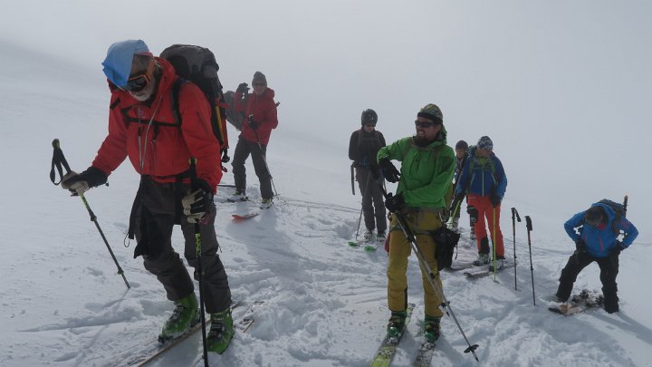
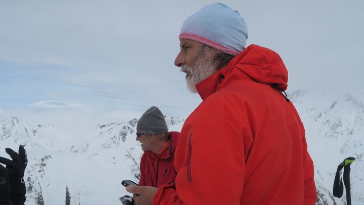
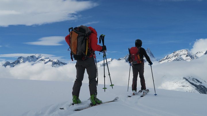
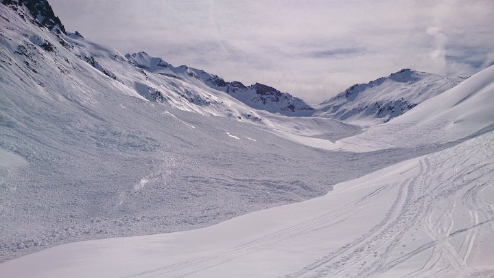
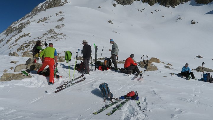
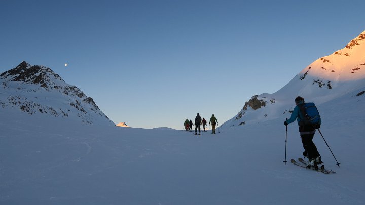
 - Rotondohütte (2'570) - Zusatztour Rottällihorn (2'911)<br />ca. 4 1/2 Std Aufstieg / Höhenmeter ca. 1'420m / Distanz 11.9 km<br />Sonnenschein pur / sehr gute Schneeverhältnisse") width:720;;height:405
width:720;;height:405
-
 width:720;;height:405
-
 width:720;;height:405
-
 width:720;;height:405
-
 width:720;;height:405
-
 width:720;;height:405
-
 width:720;;height:405
-
 width:720;;height:405
-
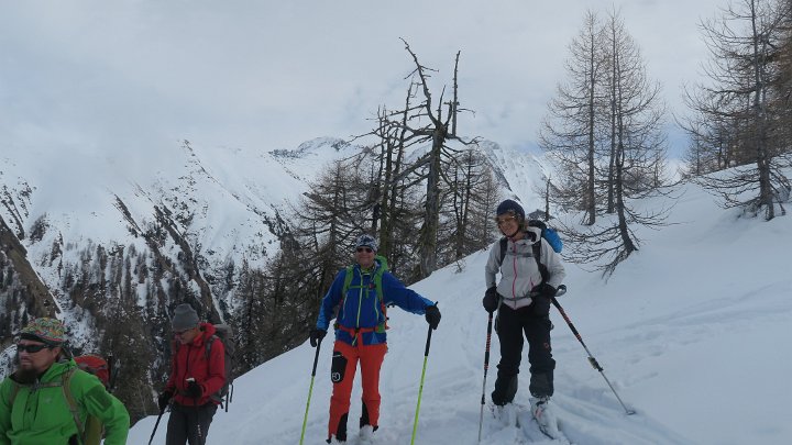
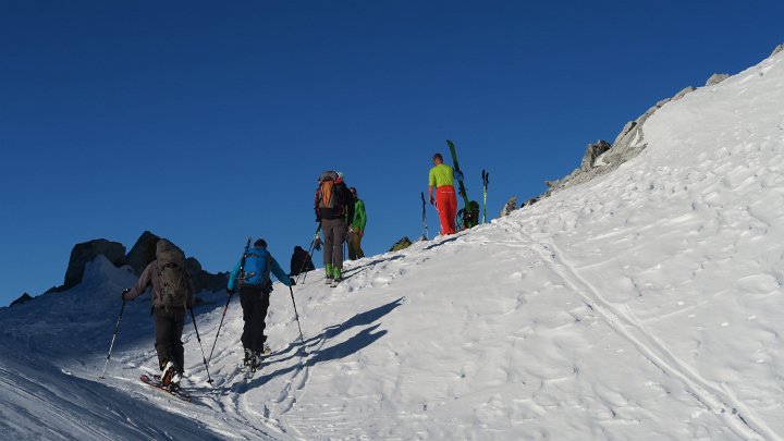
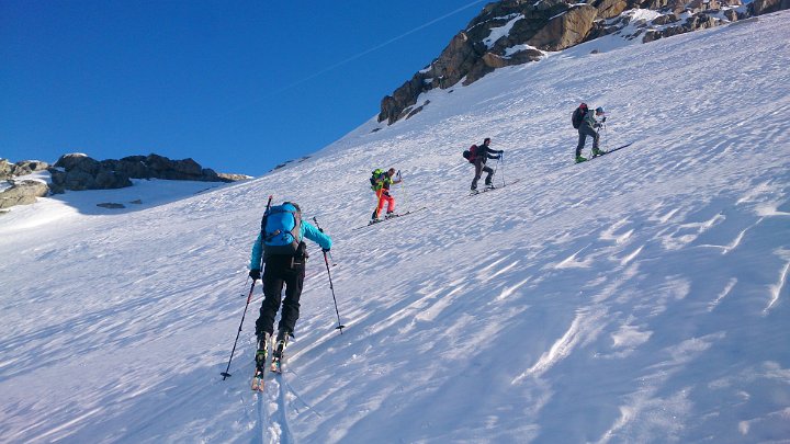
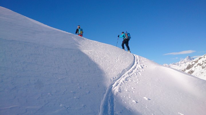
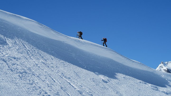
 - Witenwasserenpass (2'806) - Gerengietscher bis 2'250) - Rotondopass (2'754) - Pianseooohiitte (1'982) -<br />All‘Acqua (1'614) - Zusatztour Alpe do Formazzora (ca. 2'200) - All'Aoqua - Corno-Gries Hütte (2’338)<br />ca. 6 1 12 Std Aufstieg / Höhenmeter ca. 1'855m / Distanz 21.0km / leicht++<br />Sonnenschein pur (T—Shirt Wetter) / sehr gute Schneeverhältnis") width:720;;height:405
width:720;;height:405
-
 width:720;;height:405
-
 width:720;;height:405
-
 width:720;;height:405
-
 width:720;;height:405
-
 width:720;;height:405
-
 width:720;;height:405
-
 width:720;;height:405
-
 width:720;;height:405
-
 width:720;;height:405
-
 width:720;;height:405
-
 width:720;;height:405
-
 width:720;;height:405
-
 width:720;;height:405
-
 width:720;;height:405
-
 width:720;;height:405
-
 width:720;;height:405
-
 width:720;;height:405
-
 width:720;;height:405
-
 width:720;;height:405
-
 width:720;;height:405
-
 width:720;;height:405
-
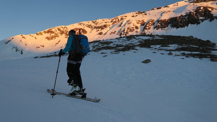
 - Cornopass (2’485) - Griessee (2'386) - Griesgletscher zum Blinnenhorn (3'374) -<br />Claudia di Bruno Hütte (I) (2'708) - Zusatztour Strahlgrätgrat (3'147) - Claudio di Bruno Hütte<br />ca 4 1/2 Std Aufstieg / Höhenmeter ca. 1'200m / Distanz 13.5km/ mittel<br />Sonnenschein pur (T-Shirt Wetter), abends aufkommender Wind / sehr gute Schneeverhältnisse") width:720;;height:405
width:720;;height:405
-
 width:720;;height:405
-
 width:720;;height:405
-
 width:720;;height:405
-
 width:720;;height:405
-
 width:720;;height:405
-
 width:720;;height:405
-
 width:720;;height:405
-
 width:720;;height:405
-
 width:720;;height:405
-
 width:720;;height:405
-
 width:720;;height:405
-
 width:720;;height:405
-
 width:720;;height:405
-
 width:720;;height:405
-
 width:720;;height:405
-
 width:720;;height:405
-
 width:720;;height:405
-
 width:720;;height:405
-
 width:720;;height:405
-
 width:720;;height:405
-
 width:720;;height:405
-
 width:720;;height:405
-
 width:720;;height:405
-
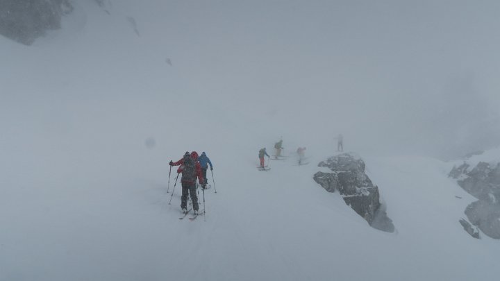
 (2'708) - Abfahrt zum Lago del Sabbione (2'463) - Hohsandjoch (2'901) - Mittlenberghütte (2’393)<br />ca. 3 1/4 Std Aufstieg/ Höhenmeter ca. 570m / mittel+ (GPS-Wetter)<br />starker Wind und Nebel / etwas Neuschnee - feucht") width:720;;height:405
width:720;;height:405
-
 width:720;;height:405
-
 width:720;;height:405
-
 width:720;;height:405
-
 width:720;;height:398
-
 width:720;;height:412
-
 width:720;;height:405
-
 width:720;;height:405
-
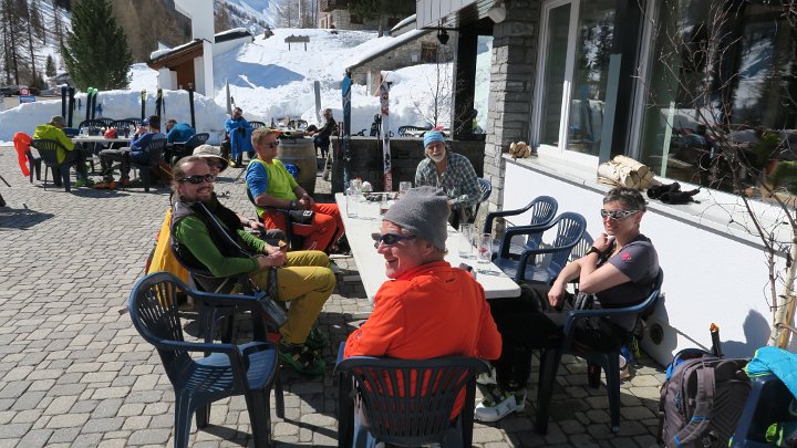
 - Mittlebärg (ca. 2'500) - Turbenwasser bis (ca. 2'220) - Furggulti (2'598) - Rappegietscher (ca. 3'000)<br />Tristul (2’580) - Chummehorn(2'754) - Grathorn (2'672) - Waldabfahrt nach Reckingen (Goms) (1'316) - Zugfahrt nach Realp<br />ca. 5 1/4 Std Aufstieg / Höhenmeter ca. 1'295m / mittel++<br />morgens Wind und Nebel, gegen Mittag Aufhellungen / über 0°, im Tal über 10° / Schlusshang von Sulz- zu Nassschnee<br />") width:720;;height:405
width:720;;height:405
-
 width:720;;height:405
-
 width:720;;height:405
-
 width:720;;height:405
-
 width:720;;height:405
-
 width:720;;height:405
-
 width:720;;height:405
-
 width:720;;height:405
-
 width:720;;height:383
-
 width:720;;height:409
-
 width:405;;height:720
-
 width:720;;height:405
-
 width:720;;height:405
-
 width:720;;height:405
-
 width:720;;height:405
-
 width:720;;height:405
-
 width:720;;height:405
-
 width:720;;height:405
 - Rotondohütte (2'570) - Zusatztour Rottällihorn (2'911)<br />ca. 4 1/2 Std Aufstieg / Höhenmeter ca. 1'420m / Distanz 11.9 km<br />Sonnenschein pur / sehr gute Schneeverhältnisse")


 - Witenwasserenpass (2'806) - Gerengietscher bis 2'250) - Rotondopass (2'754) - Pianseooohiitte (1'982) -<br />All‘Acqua (1'614) - Zusatztour Alpe do Formazzora (ca. 2'200) - All'Aoqua - Corno-Gries Hütte (2’338)<br />ca. 6 1 12 Std Aufstieg / Höhenmeter ca. 1'855m / Distanz 21.0km / leicht++<br />Sonnenschein pur (T—Shirt Wetter) / sehr gute Schneeverhältnis")


 - Cornopass (2’485) - Griessee (2'386) - Griesgletscher zum Blinnenhorn (3'374) -<br />Claudia di Bruno Hütte (I) (2'708) - Zusatztour Strahlgrätgrat (3'147) - Claudio di Bruno Hütte<br />ca 4 1/2 Std Aufstieg / Höhenmeter ca. 1'200m / Distanz 13.5km/ mittel<br />Sonnenschein pur (T-Shirt Wetter), abends aufkommender Wind / sehr gute Schneeverhältnisse")


 (2'708) - Abfahrt zum Lago del Sabbione (2'463) - Hohsandjoch (2'901) - Mittlenberghütte (2’393)<br />ca. 3 1/4 Std Aufstieg/ Höhenmeter ca. 570m / mittel+ (GPS-Wetter)<br />starker Wind und Nebel / etwas Neuschnee - feucht")


 - Mittlebärg (ca. 2'500) - Turbenwasser bis (ca. 2'220) - Furggulti (2'598) - Rappegietscher (ca. 3'000)<br />Tristul (2’580) - Chummehorn(2'754) - Grathorn (2'672) - Waldabfahrt nach Reckingen (Goms) (1'316) - Zugfahrt nach Realp<br />ca. 5 1/4 Std Aufstieg / Höhenmeter ca. 1'295m / mittel++<br />morgens Wind und Nebel, gegen Mittag Aufhellungen / über 0°, im Tal über 10° / Schlusshang von Sulz- zu Nassschnee<br />")